Google Earth has opened up a whole new world of exploration by revealing everything from hidden landmarks to mysterious anomalies. While it’s a handy tool for finding new places to visit, it’s also become a fascinating space for uncovering the world’s weirdest and creepiest finds. Let’s take a look at 50 jaw-dropping Google Earth discoveries!
Airplane Boneyard
32 08’59.96″ N, 110 50’09.03″W
Tucson, Arizona
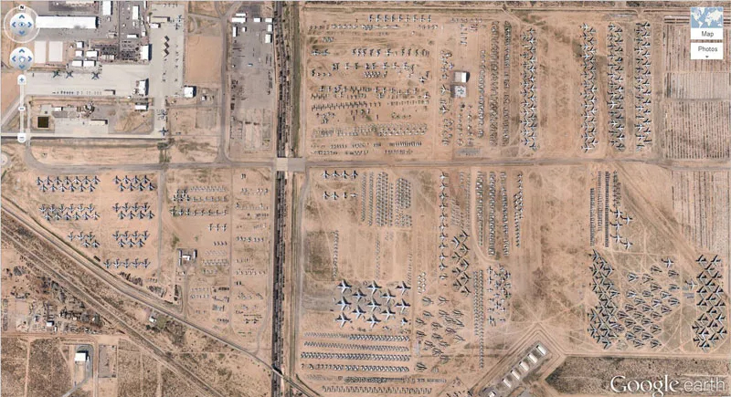
Officially known as the 309th Aerospace Maintenance and Regeneration Group, this “Airplane Boneyard” storage facility holds over 4,000 retired aircraft. Spanning over 2,600 acres, it’s where old planes go to rest, and where iconic planes like B-52s and F-16s gather dust in the Arizona desert.
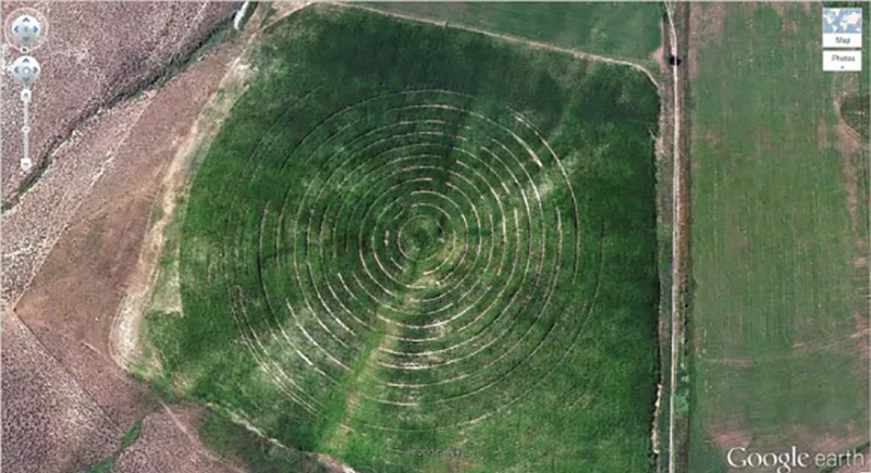
Mysterious Desert Pattern
27°22’50.10″N, 33°37’54.62″E
Red Sea Governorate, Egypt
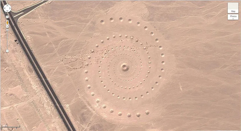
The mysterious spiral pattern in Egypt’s Red Sea Governorate might look like an ancient enigma, but it’s actually a modern land art project. It’s known as the Desert Breath, and is an installation created by the D.A.ST. Arteam in 1997. It features 89 conical mounds arranged in a hypnotic spiral.
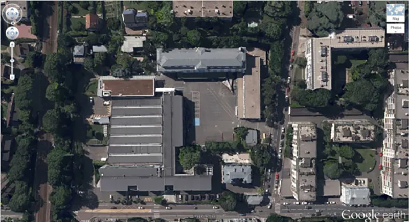
Controversially Shaped Building Complex
32°40’34.19″N 117° 9’27.58″W
Coronado, California, USA
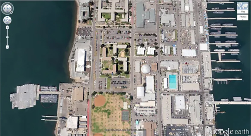
This aerial view of a building complex in Coronado, California, reveals a swastika shape, and was constructed during WWII as part of a base. Though the shape is coincidental, it raises eyebrows due to its historical and visual significance. The controversial appearance has led to various conspiracy theories over time.
Buffalo Herd
4°17’21.49″ S 31°23’46.46″ E
Kigosi Game Reserve, Tanzania

This herd looks like a natural work of art, with the buffalo moving in unison across the terrain. Buffalo are known for their strength and social nature, often gathering in large groups like this to protect each other from predators.
Giant Triangle
33.747252, -112.633853
Wittmann, Arizona, USA
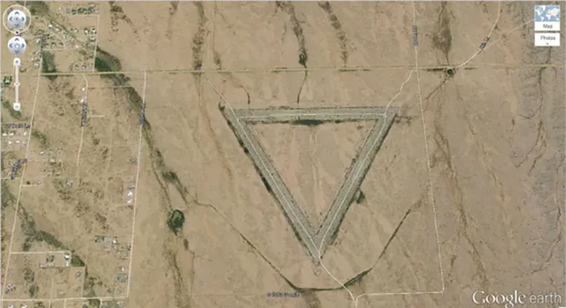
This giant triangle looks like it could be the work of extraterrestrials, but it’s actually a human-made creation, which is a huge part of a former radar testing facility. While its eerie appearance may make it seem like something out of a sci-fi movie, the triangle’s purpose was purely for research.
Shipwrecked SS Ayrfield with Trees
-33.836379, 151.080506
Homebush Bay, Sydney, Australia
Floating eerily in Sydney’s Homebush Bay, the abandoned SS Ayrfield has transformed into a “Floating Forest.” Mangroves burst through their rusted hulls and create a unique mix of steel and lush greenery. Once a WWII supply ship, it’s now a hauntingly beautiful reminder of nature reclaiming what’s left behind.
The Badlands Guardian
50° 0’38.20″N 110° 6’48.32″W
Walsh, Alberta, Canada
Spotted in Alberta’s badlands, the “Badlands Guardian” looks freakishly like a person’s head wearing a Native headdress. It’s a natural landform shaped by erosion. The “earbud” effect is actually just a road and a well pad in just the right spot.
Parking Lot for Fighter Jets
33.927911, -118.38069
El Segundo, California, USA
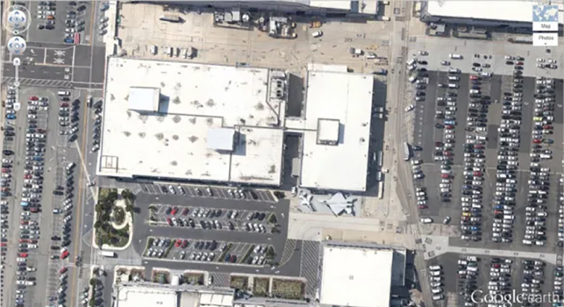
Between office buildings in El Segundo, California, a group of fighter jets sits casually in what looks like a corporate parking lot. They belong to a Northrop Grumman facility nearby. It’s not every day military aircraft share space with sedans and SUVs, but here, it’s normal.
Firefox Logo
45° 7’25.87″N 123° 6’48.97″W
Dayton, Oregon, USA
No, this isn’t a work of aliens—it’s a giant Firefox logo carved by a group of Oregon State University students in 2006 into a field to celebrate 50 million downloads. It measures over 220 feet wide and is still one of the geekiest stunts seen from space.
Guitar-Shaped Forest
-33.867886, -63.987
Córdoba, Argentina
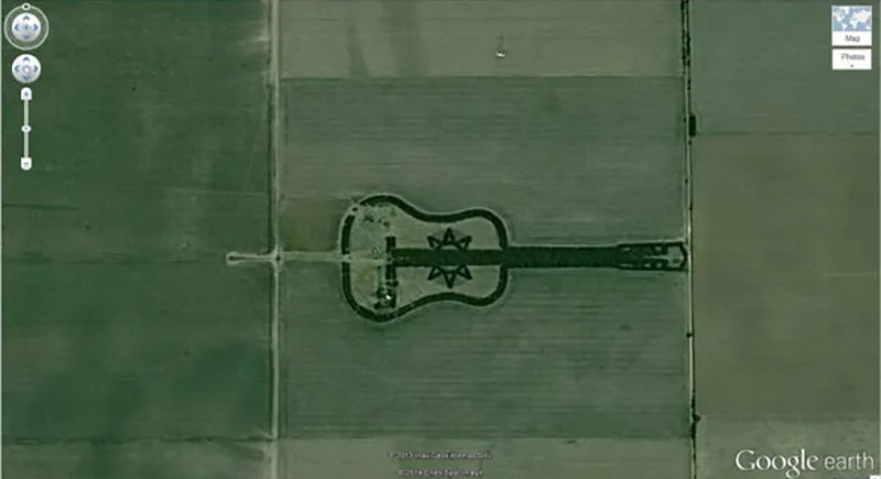
In the flat farmlands of Córdoba, Argentina, a giant guitar made of over 7,000 trees stretches across the ground. It was created by farmer Pedro Martin Ureta in memory of his late wife, and spans nearly 2,000 feet.
Heart-Shaped Lake
41.303921, -81.901693
Columbia Station, Ohio, USA
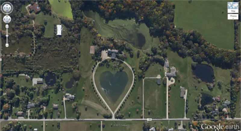
A heart-shaped lake in Ohio is visible only from above. The private property owner sculpted it with care and turned a regular pond into a huge symbol of love. Trees and a driveway perfectly trace the heart’s outline.
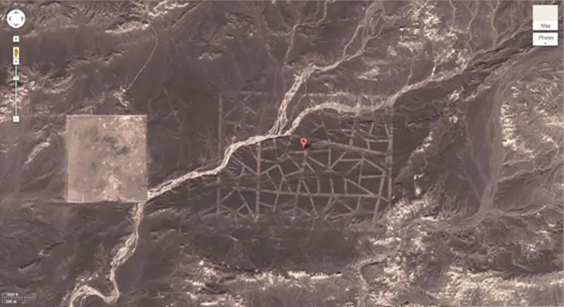
Mysterious Desert Pattern
40.452107, 93.742118
China
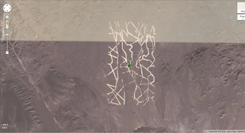
These strange white lines crisscross the desert in China’s Xinjiang region with a pattern that has puzzled online viewers for years. Some guess it’s a satellite calibration grid, and others suspect it is part of official testing.
Giant Target
37.563936, -116.85123
Nevada, USA
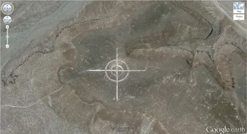
A giant bullseye lies etched into the Nevada desert while drawing curious eyes on Google Earth. It’s known as an aerial photo calibration target, and helps aircraft and satellites fine-tune their cameras. Engineers created many of these in the past, and decades after their original use, they still stand out clearly from orbit.
World’s Biggest Pool
-33.350534, -71.653268
Algarrobo, Valparaíso, Chile
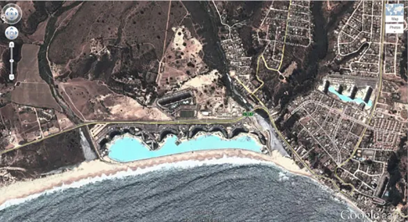
The San Alfonso del Mar resort in Chile has a pool that is so huge it looks like a turquoise lagoon from space. It stretches over 3,300 feet, covers nearly 20 acres, uses filtered seawater, and holds more than 66 million gallons. Swimmers can even kayak across it!
Jesus Loves You
43.645074, -115.993081
Boise National Forest, Boise, Idaho, USA
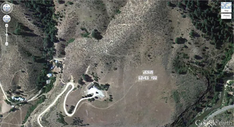
Large white letters on a hillside near Boise, Idaho spell out “JESUS LOVES YOU,” clearly visible from satellite view. The message sits on private land near the Boise National Forest and has sparked curiosity online.
Lion King
51.848637, -0.55462
Dunstable LU6 2LD, UK
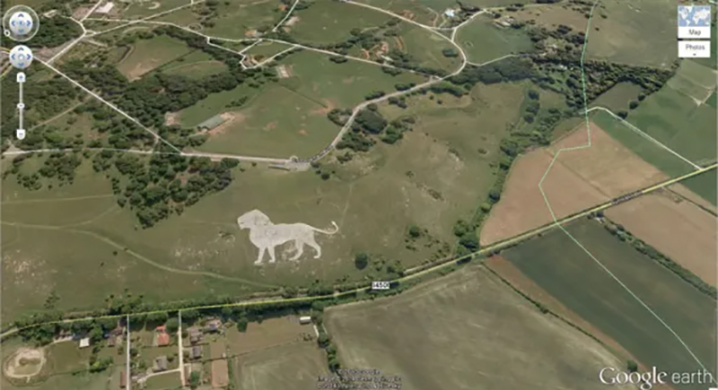
Locals call this giant lion figure the “Whipsnade Lion,” originally created in 1933 to promote the nearby Whipsnade Zoo. Workers used white chalk to form the shape, and it stretches over 483 feet long. Even after nearly a century, it still catches the eye.
Northern Cyprus Flag
35.282902, 33.376891
Kyrenia, Cyprus
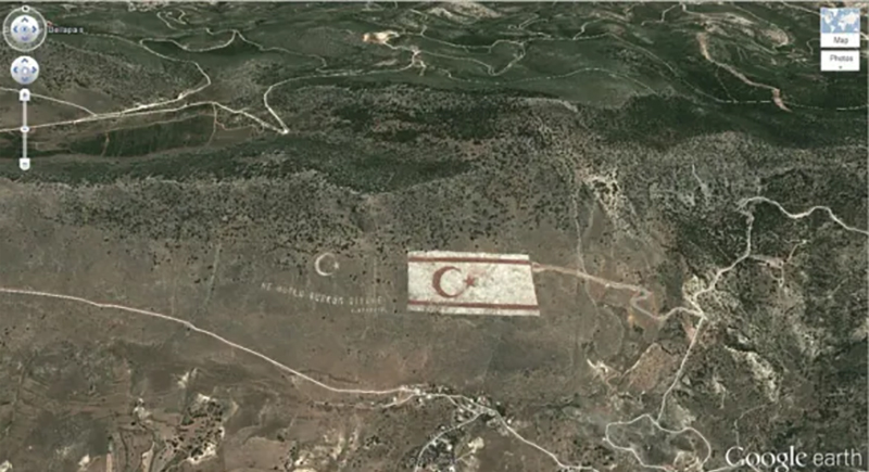
The Northern Cyprus flag stretches hundreds of feet wide and includes a bold red crescent and star. Workers added lights to make it visible at night. Political tension surrounds the display, but the sheer scale of this national symbol makes it impossible to miss.
Star Fort
Schansdijk 5, 4655 De Heen, The Netherlands
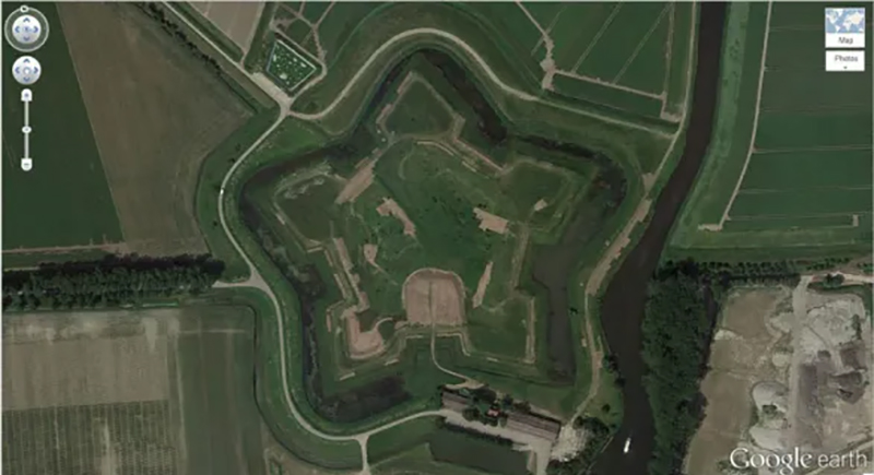
Fort Bourtange shows off a perfect five-point star shape. Engineers built it in 1593 to control a key road during the Dutch Revolt. The moats and walls form sharp geometric lines designed for defense. Today, it functions as a museum and historic site.
Potash Ponds
38°29’0.16″N 109°40’52.80″W
Moab, Utah, USA
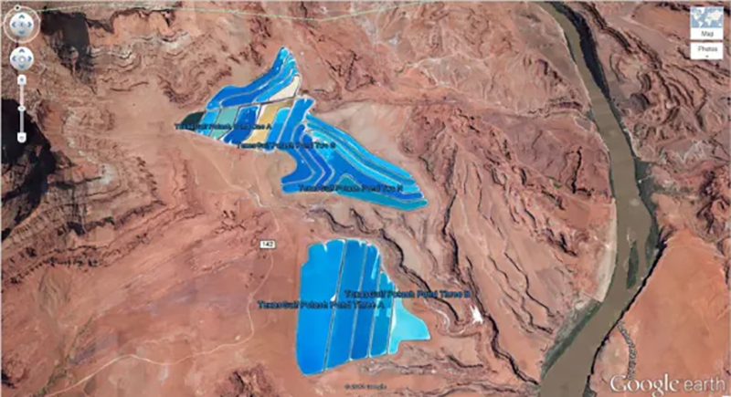
Bright blue shapes near Moab draw attention instantly, but they’re not natural. These are potash evaporation ponds, used to harvest potassium chloride from underground brine. Workers pump the brine to the surface, then let sunlight evaporate the water. Blue dye speeds up the process and gives the ponds their striking color.
Mysterious Pattern
37.629562, -116.849556
Nevada, USA
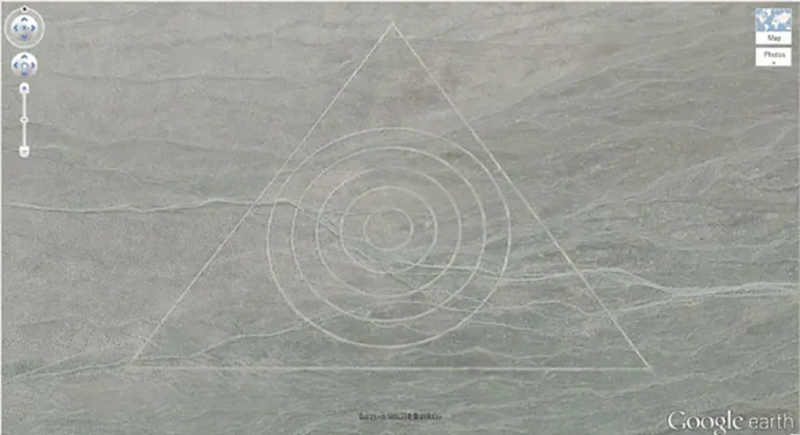
Within the Nevada desert, a massive triangle enclosing concentric circles has sparked plenty of speculation. Theories suggest that it’s either part of old testing grounds or another calibration target like those used during the world conflict. The exact purpose remains unclear.
The Whampoa Boat-Shaped Shopping Centre
22°18’14.15″N, 114°11’24.66″E
Hung Hom, Kowloon, Hong Kong
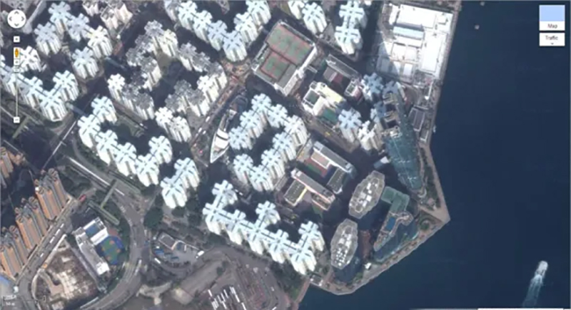
Right in the middle of Hong Kong’s dense Hung Hom district, a cruise ship appears docked among apartment blocks, but it never moves. That’s the Whampoa Shopping Centre, which developers built on the site of the old Whampoa Dockyard, and turned shipbuilding history into a floating illusion on land.
Russell Square
Bloomsbury, London, United Kingdom
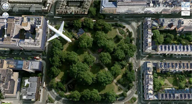
A low-flying plane appears to hover over Russell Square in London, captured perfectly mid-flight by satellite imagery. The square is a peaceful green space surrounded by classic Georgian architecture. The plane’s unexpected appearance is a photobomb from 30,000 feet.
Coca Cola Logo
-18.529211, -70.249941
Arica, Arica y Parinacota, Chile
In the desert near Arica, Chile, the Coca-Cola logo spans over 160,000 empty Coke bottles arranged to form the brand’s name. The company created it in 1986 to celebrate 100 years of Coca-Cola. It’s definitely one of the world’s strangest ads.
Concentric Circles
39.623119, -107.635353
New Castle, Colorado, USA
Perfectly spaced concentric circles cover a green field near New Castle, Colorado. While the pattern looks like a coded message or crop circle, it most likely comes from a precision irrigation system or soil treatment process. Farming equipment can leave behind surprisingly clean designs, especially when guided by GPS.
Island in a Lake in an Island in a Lake
69.793° N, 108.241° W
Northern Canada
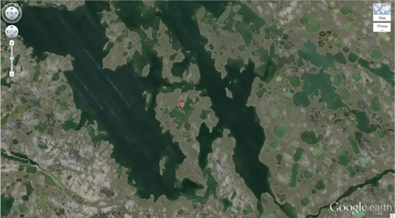
A tiny island sits inside a lake, which sits on an island, inside another lake. This geographic oddity fascinates map lovers and geography buffs alike. It’s one of the most well-known examples of a naturally occurring “recursive island” worldwide and is officially recognized by Guinness World Records.
Flipped Car
51°19’18.13″N, 6°34’35.64″E
Krefeld, Germany
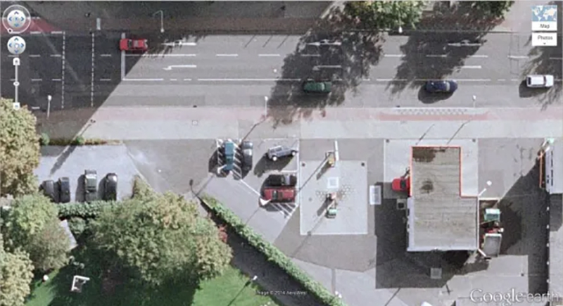
In the middle of a quiet gas station, a single car rests on its side with no skid marks, debris, or damaged nearby vehicles. Everything else looks perfectly normal. The flipped car feels out of place, like a freeze-frame from a glitch in reality or a very strange prank.
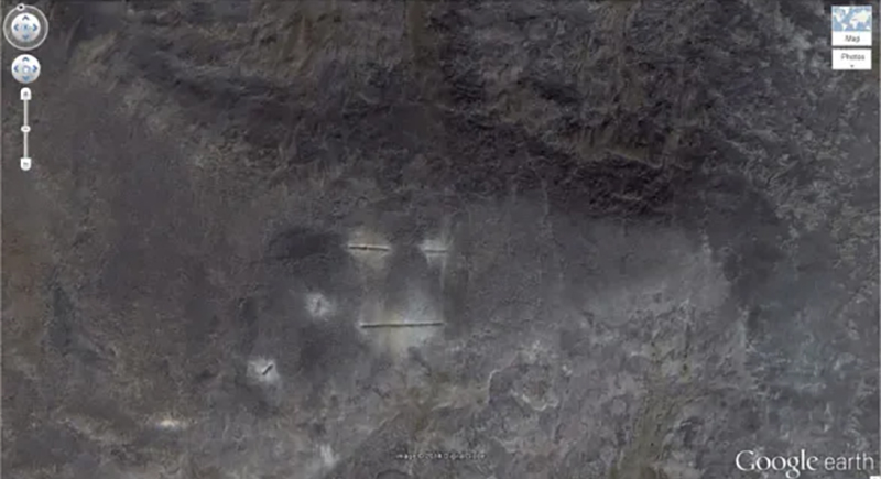
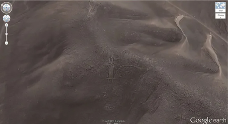
Strange Symbol
37.401573, -116.867808
Nevada, USA
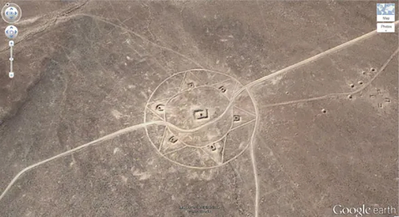
With circles, triangles, and a square spiral in the center, this large geometric symbol etched into the Nevada desert almost looks ritualistic. However, the design actually marks the location of a long-abandoned aerial range. What appears mysterious is likely the remains of target practice.
Monkey Face
65.476721, -173.511416
Russia
High in the rugged terrain of eastern Russia, a natural rock formation resembles a monkey’s face. The shape stands out with deep shadows forming eyes, a nose, and a wide mouth. It’s likely a case of pareidolia—when the brain spots faces in random patterns. Still, it’s oddly lifelike.
Big Swimming Pool
52°29’52.24″N 13°27’13.67″E
Berlin, Germany
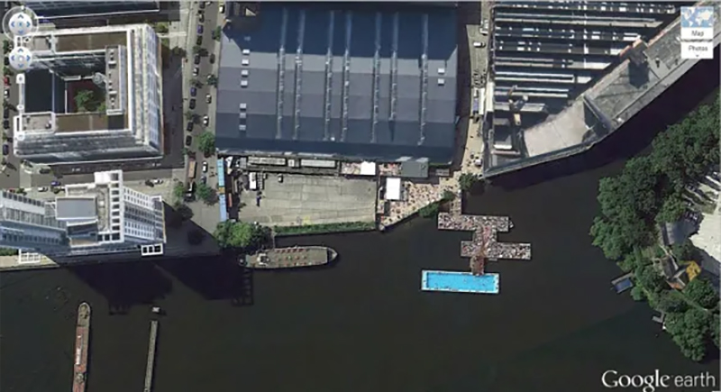
Berlin’s Badeschiff (which means “bathing ship”) stands out with its bright blue rectangular pool. It was originally built from a converted barge, and gives swimmers a clean, contained spot to enjoy the river’s scenery without diving into the actual water. Locals love it, especially during summer months.
A Most Phallic Building
41.84201, -89.485937
Dixon, Illinois, USA
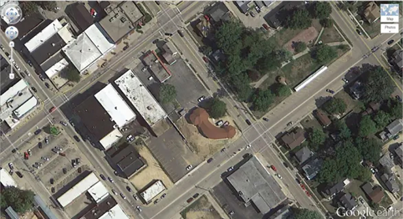
A small red-roofed building in Illinois unintentionally grabs attention from above due to its very suggestive shape. When viewed on Google Earth, the structure’s outline resembles a phallic symbol and sparks plenty of jokes online. On the ground, it looks completely ordinary—just an odd coincidence of architecture and satellite perspective.
Big Friendly Giant
19°56’56.96″S 69°38’1.83″W
Huara, Tarapacá, Chile
From the sky, this looks like a giant waving hello. The Atacama Giant stands 390 feet tall and is one of the largest prehistoric geoglyphs in the world. It was created between 1000 and 1400 AD by the indigenous Tiwanaku people, and it’s said that the figure may have served as an astronomical guide.
Another Jet in a Parking Lot
48.825183, 2.1985795
92410 Ville-d’Avray, France
In the middle of a neighborhood in France, a full-sized jet casually rests in a parking lot. It isn’t abandoned or crashed—just part of the campus at the École nationale supérieure des techniques avancées, a prestigious engineering school. The aircraft likely serves as a static training or display model.
More Mysterious Desert Patterns
40.458148, 93.393145
China
Deep in China’s Gobi Desert lies a grid of bright white lines stretched across the ground with no clear purpose. The layout resembles a street map but leads nowhere. Analysts believe these markings may serve as satellite calibration zones or official testing layouts, but officials haven’t confirmed their function.
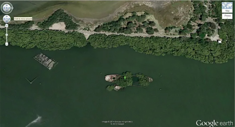
Shipwreck
30.541634, 47.825445
Basrah, Iraq
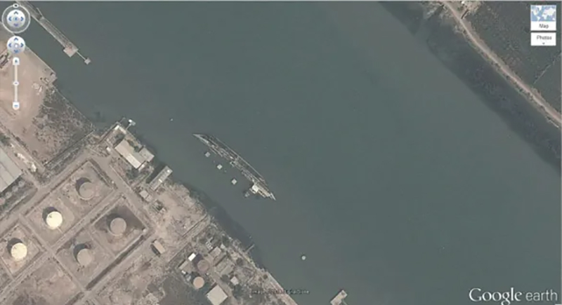
A rusting shipwreck rests half-submerged in the Shatt al-Arab waterway near Basrah, Iraq. Though likely a casualty of past conflicts, the vessel appears frozen in time and tilts slightly in the murky water. Satellite images capture its quiet decay and offer a stark reminder of the long-lasting scars left behind.
Multiple Landing Strips in the Desert
32.663367, -111.487618
Eloy, Arizona, USA
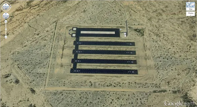
Five identical black landing strips sit side by side in Arizona, looking ready for use—but no planes ever land. These might be skydiving target zones built for training and competitions. They resemble runways, but on the ground, they serve as drop zones for parachutists perfecting their accuracy.
Oil Fields
37°39’16.06″S 68°10’16.42″W
Rio Negro, Argentina
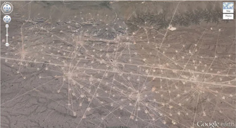
A dense network of dirt roads and drill pads fans out across the desert in Río Negro, Argentina. These are oil fields, and each white dot connects to a wellhead. The layout seems to form a massive spiderweb of energy infrastructure, built to extract petroleum from the region’s underground reserves.
Mattel Logo
33.921277, -118.391674
El Segundo, California
A giant Mattel logo sits boldly on a landscaped lawn in El Segundo, California, just outside the company’s headquarters. It’s a fitting move from the toy giant behind Barbie and Hot Wheels—clearly designed with satellite imagery and brand visibility in mind.
Uluru / Ayers Rock
-25.344375, 131.034401
Northern Territory, Australia
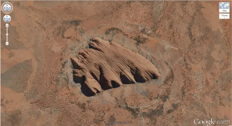
Uluru’s deep ridges make it one of Earth’s most recognizable natural features. Although tourists once climbed it, the site was officially closed to climbers in 2019 out of respect for its cultural importance. The Anangu people consider it sacred, with legends tied to nearly every crease carved into its surface.
1:20 Scale Model of Disputed Border Region
between India and China
38.265652, 105.9517
Yong Ning Xian, Yinchuan, Ningxia, China
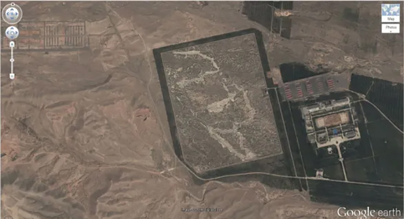
A massive rectangular plot in Ningxia, China, holds a detailed 1:20 scale model of the contested border region between India and China. Analysts believe planners use it for training exercises and simulations. The artificial terrain mimics real-world topography.
UTA Flight 772 Desert Memorial
16.864841, 11.953808
Sahara Desert, southern Ténéré of Niger
In the remote sands of the Sahara, a haunting airplane silhouette marks the crash site of UTA Flight 772. Family members and volunteers built the memorial in 2007 using dark stones and scrap metal from the wreckage. It honors the 170 lives lost in the 1989 chaos.
Heart-Shaped Land Formation
20°56’15.47″S, 164°39’30.56″E
New Caledonia
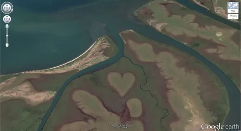
Just off the coast of New Caledonia, nature shapes a perfect heart right into the mangroves. Locals call it the “Heart of Voh,” and it grabbed the world’s attention after landing on the cover of Earth from Above.
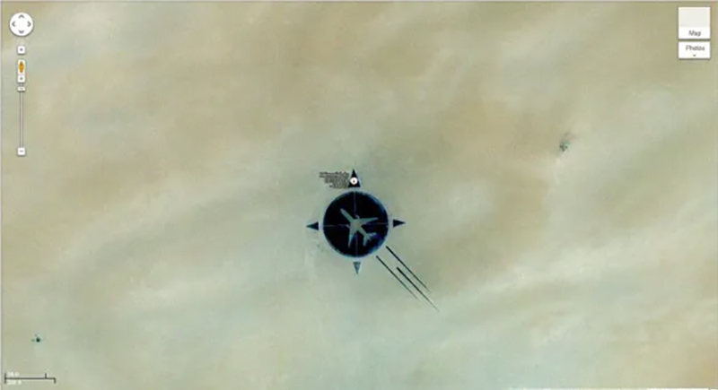
Rainbow Plane
Cathy Terrace Englewood Cliffs, New Jersey, USA
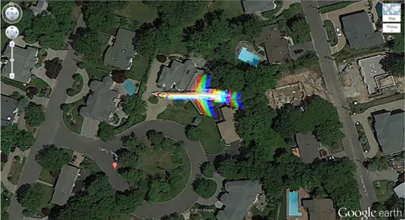
A happy accident in pixel form produced a rainbow-colored airplane that appears to fly low over a neighborhood. But it’s just a quirky artifact of satellite imaging. The camera’s color sensors captured each wavelength slightly out of sync.
Barringer Meteor Crater
35.027185, -111.022388
Winslow, Arizona
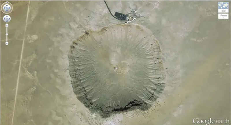
Barringer Meteor Crater marks where a 160-foot-wide meteor slammed into Earth around 50,000 years ago. It looks like Earth took a direct punch and never quite smoothed it out. It’s also open to visitors—because who wouldn’t want to stand at ground zero of a cosmic collision?
Come Downtown and Play
35.141533, -90.052695
Memphis, Tennessee, USA
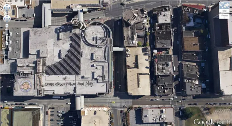
On top of the former Peabody Place mall in downtown Memphis, the words “come downtown and play” still stretch across the roof. The lively entertainment and retail hub has since closed, but the rooftop message remains cheerful and oddly nostalgic, like a ghost ad visible only from the sky.
Hippo Pool
6°53’53.00″ S 31°11’15.40″ E
Katavi National Park, Tanzania
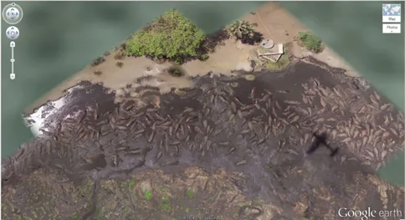
Hundreds of hippos pack tightly into a muddy pool in Katavi National Park, Tanzania. It looks chaotic, but this is prime hippo real estate during the dry season. As water shrinks, these massive animals crowd into the last remaining puddles, jostling for space while keeping cool and hydrated.
Solar Field
34.871778, -116.834192
Daggett, California
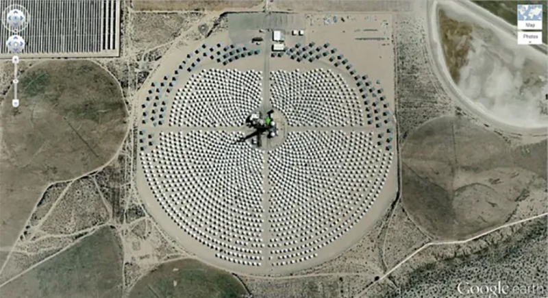
It looks like aliens set up camp—but nope, it’s just solar power doing its thing. This setup is part of a solar thermal power plant, where sunlight gets focused to heat things up and spin turbines. It’s not a secret base or anything like most would assume.
Giant US Flag
7300 Airport Blvd, Houston, TX 77061, USA
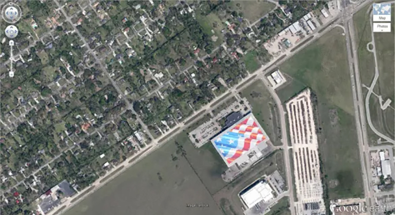
One rooftop near Houston’s Hobby Airport is painted in bold red, white, and blue and covers the entire top of a building. It’s visible from incoming flights, and proudly grabs attention before passengers even touch down.
Big Red Lips in the Desert
12°22’13.32″N, 23°19’20.18″E
Sudan
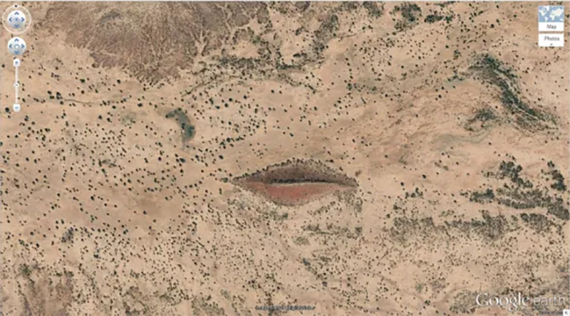
In the middle of Sudan’s desert, the ground looks like it’s puckering up. A natural ridge, a splash of red soil, and some strategic greenery form what looks exactly like a giant pair of lips.
Grand Prismatic Spring
44.525049, -110.83819
Yellowstone National Park, Wyoming, USA
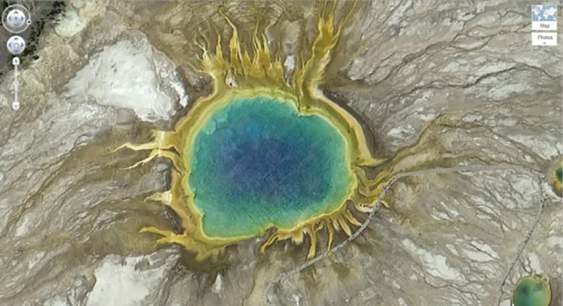
Yellowstone’s Grand Prismatic Spring looks like Earth decided to show off its color palette. This giant hot spring dazzles from space with blue, green, yellow, and orange. Bacteria and heat-loving microbes create the rainbow effect, not Photoshop. It’s the largest spring in the U.S., and definitely the most flamboyant.
Batman Symbol
26.357896, 127.783809
Okinawa, Japan
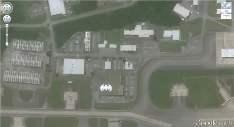
At Kadena Air Base in Okinawa, Japan, the Batman logo boldly covers a rooftop like a superhero’s calling card. It was painted in the 1980s, and represents the 44th Fighter Squadron—also known as the “Vampire Bats.” There’s No word on whether Batman actually shows up.