Even with GPS at our fingertips, many geography myths about the U.S. still slip through the cracks. Some are holdovers from outdated textbooks, while others just sound true enough to stick. State borders, direction extremes, or who owns what landmark are commonly believed geography errors that could surprise even the most confident map-readers.
Myth: The Statue of Liberty Is in New York
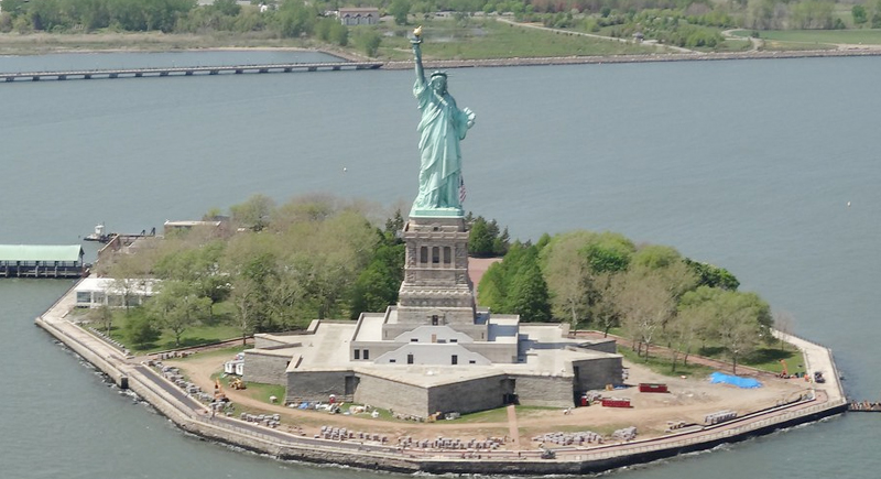
She’s a New York icon, no doubt—but Lady Liberty stands in waters belonging to New Jersey. While Liberty Island itself is under New York jurisdiction thanks to an old agreement, it’s located much closer to the Jersey shoreline. Even the state’s historical register lists it as part of New Jersey.
Myth: Kansas City Is Only in Kansas

It’s easy to assume Kansas City is just…in Kansas. However, the metro area is split down the middle, and the more prominent half, including downtown and the Chiefs’ stadium, sits in Missouri. Both states have their own Kansas City, each with its own government.
Myth: Florida Holds the Southernmost Point in the U.S.
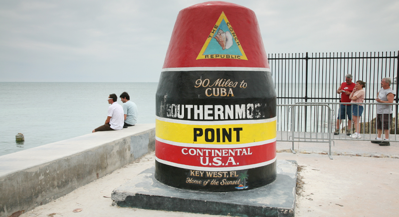
That colorful concrete marker in Key West claims the title, but it’s not quite accurate. Hawaii dips closer to the equator than Florida ever does, by several hundred miles. The marker’s technically accurate for the continental U.S., but if you zoom out and check the coordinates, Hawaii takes the win.
Myth: Maine Is the Easternmost State
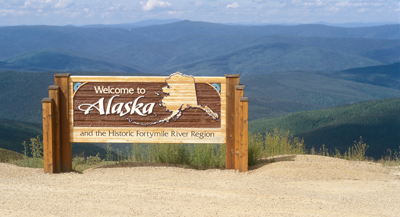
Maine seems as far east as you can go, but Alaska steals the title. That’s because part of the Aleutian Islands crosses the 180th meridian, which makes Alaska the easternmost and westernmost state. Geography lines don’t always match up with where the sun rises.
Myth: You Can’t See Russia from the U.S.
Yes, you can. Russia’s Big Diomede Island is visible just 2.4 miles away on Alaska’s Little Diomede Island. The International Date Line splits them. So while you might not see Red Square, you can look across the Bering Strait and spot Russian land.
Myth: Mexico Is Always South of the United States
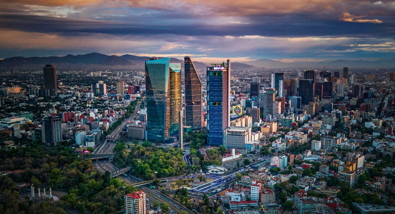
It feels true, but it’s not quite right. Due to the curve in the U.S.–Mexico border, several U.S. states dip farther south than some of Mexico’s northernmost points, including Florida and Texas. That twist in geography makes for one surprising map check.
Myth: The Mississippi Is the Longest River in the U.S.
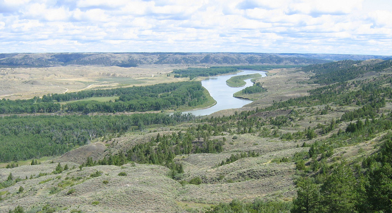
The Mississippi gets all the fame, but it is not the country’s longest river. That honor goes to the Missouri River, which stretches about 100 miles farther before it joins the Mississippi near St. Louis. They form a mighty system together, but the Missouri edges it out if we count distance alone.
Myth: Every State Follows Daylight Saving Time
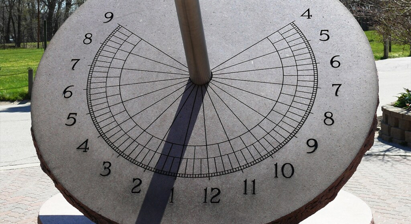
That’s false. Hawaii skips it entirely, and Arizona mostly opts out, too, except for the Navajo Nation, which does observe it. This means Arizona could be aligned with Pacific or Mountain Time depending on the month. It’s a real scheduling headache.
Myth: Antarctica Doesn’t Have Time Zones
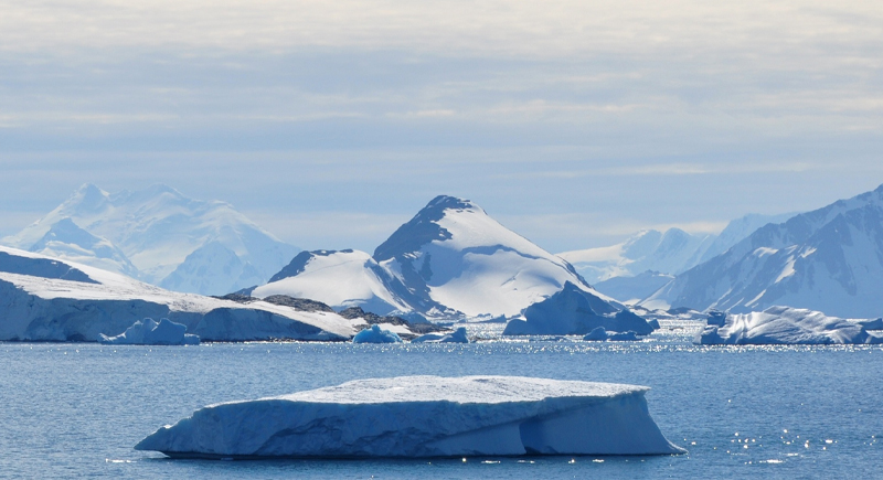
It might feel like time stands still at the bottom of the world, but Antarctica does use time zones. Research stations typically follow the time of their home country or supply routes, and American bases often run on New Zealand time. So, while it’s unconventional, clocks do tick across the continent.
Myth: Chicago Is the Capital of Illinois
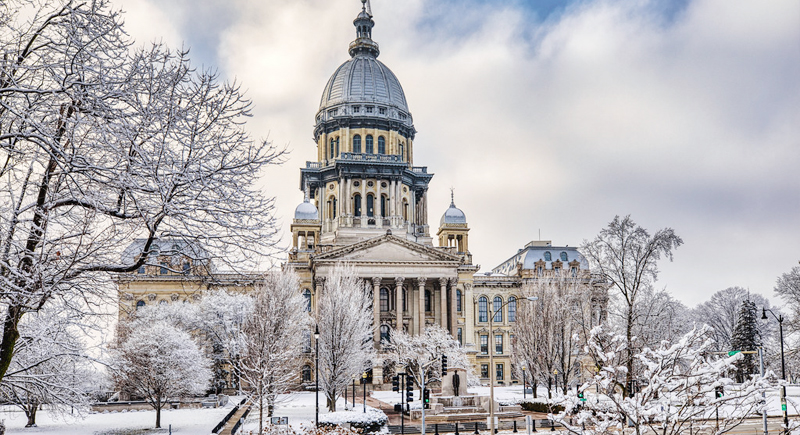
Many people assume the biggest city gets to be the capital. But in Illinois, that title belongs to Springfield. The choice was made to keep the capital centrally located, back when people traveled by wagon, not expressway.
Myth: Only Ohio Has Buckeye Trees

Ohio’s nickname, “Buckeye State,” comes from the buckeye tree, but it’s not the only place they grow. These trees can also be found in parts of Indiana, Illinois, and Pennsylvania. The association with Ohio stuck because of early settlers, local pride, and, of course, Ohio State’s football legacy.
Myth: Texas Is the Largest State in the Country
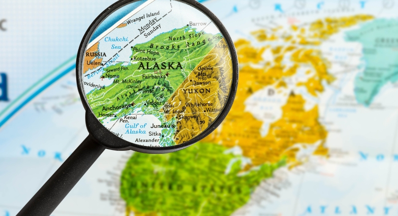
It used to be the biggest—until Alaska entered the scene. Alaska covers over twice the land area of Texas, making it the true giant on the map. While Texans still hold onto their “everything’s bigger” reputation, the numbers don’t lie: Alaska is king in size.
Myth: Lake Superior Belongs Entirely to the U.S.
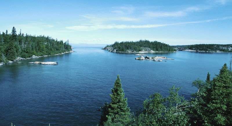
It’s easy to think of Lake Superior as purely American since it borders three U.S. states. But its northern edge belongs to Canada, which controls nearly half the lake. Like several Great Lakes, it’s a shared resource, with both countries holding a piece of its expansive waters.
Myth: Mount Rushmore Is in Colorado
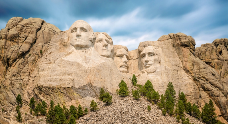
Plenty of travelers mistakenly place Mount Rushmore in Colorado, likely because they associate it with the Rocky Mountains. But the monument is actually carved into the granite of South Dakota’s Black Hills. It’s closer to Rapid City than Denver, and no part of it is anywhere near the Colorado border.
Myth: Nevada Has the Most Casinos
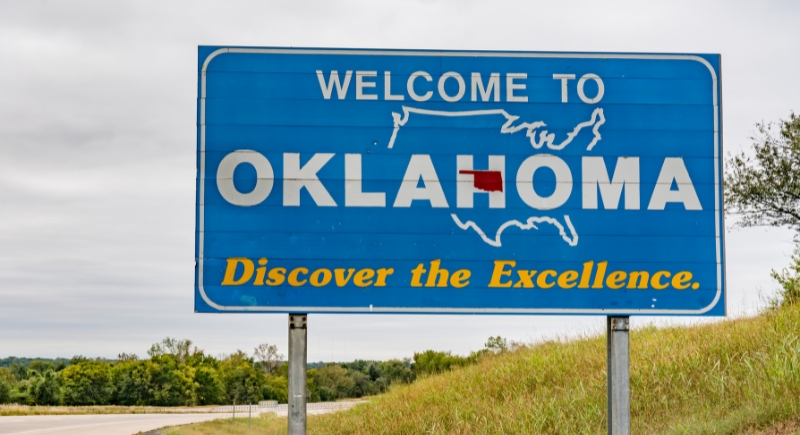
When people think of casinos, they think of Nevada. Las Vegas might be the glitzy capital, but Oklahoma quietly takes the lead regarding the total number of casinos. Thanks to dozens of tribal casinos across the state, it outpaces Nevada in quantity, though not in bright lights.
Myth: U.S. Shares Only Two Land Borders
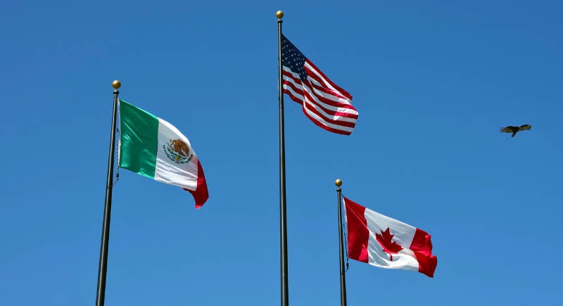
It’s easy to picture the United States as a global neighbor with borders all over the place, but in reality, it shares land borders with just two countries: Canada and Mexico. That’s it. There are no secret bridges to Europe or tunnels to Asia. For all its size, the United States only has the ocean everywhere else.
Myth: The Appalachian Mountains Are Taller Than the Rockies
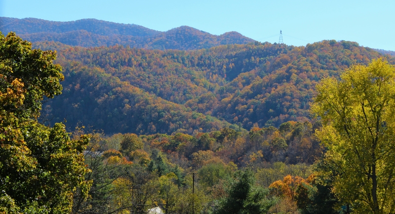
The Appalachian Mountains may have that ancient, wise-grandpa energy, but they’re not taller than the Rockies. Not even close. While the Appalachians have been around way longer, time has worn them down. The Rockies, meanwhile, are the flashy younger sibling with taller and snow-capped peaks. Age doesn’t always come with height, especially when erosion has been working overtime.
Myth: The U.S. Has No Deserts
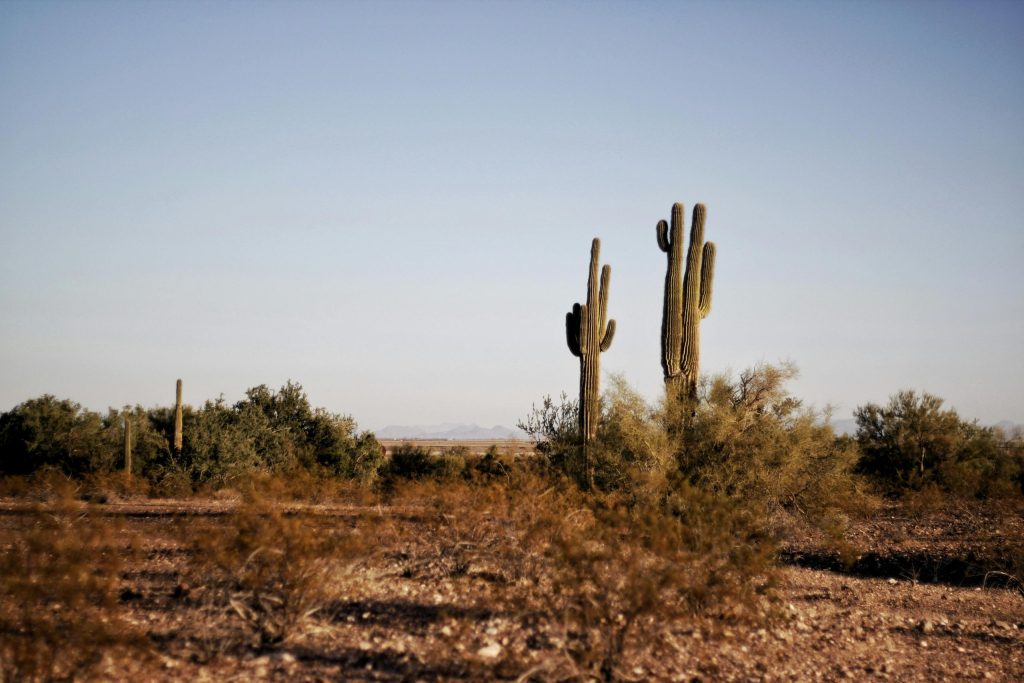
Many imagine America as endless farmland, bustling cities, and dense forests – but deserts? Not so much. The U.S. has four central deserts: the Mojave, Sonoran, Chihuahuan, and Great Basin. They span parts of California, Arizona, Nevada, New Mexico, Texas, and beyond. Turns out, America isn’t just amber waves of grain – it’s got dunes for days.
Myth: The Great Lakes Are Just Lakes
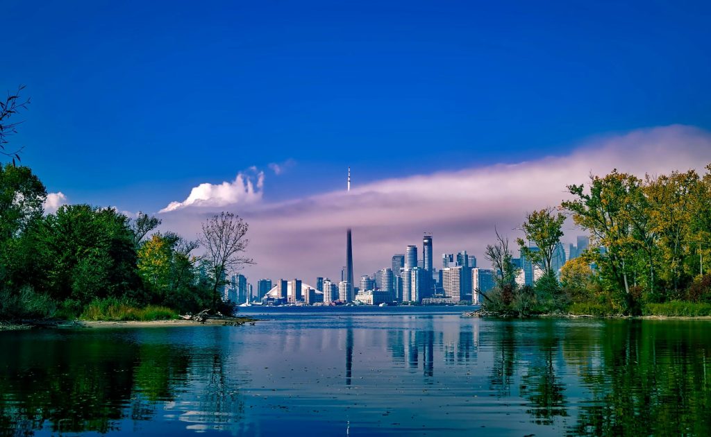
These aren’t your average fishing holes; they’re technically inland seas. The Great Lakes are so massive that they create their weather patterns, complete with snowstorms. Superior alone could swallow entire states like Massachusetts and still have room for dessert.