Most people think they know the basics of geography—until someone asks them to point out a country on a map or name the longest river in the world. Turns out, it’s a common struggle. The National Geographic-Roper 2002 Global Geographic Literacy Survey found that about 11 percent of young citizens of the U.S. couldn’t even locate the U.S. on a map.
Geography just isn’t something we revisit much after school. But in a world where travel is easier, cultures are more connected, and international headlines are part of daily life, knowing where things are—and why it matters—is more useful than ever. Here are some surprisingly tricky geography questions that still trip people up.
The Nile River: Still the Longest?
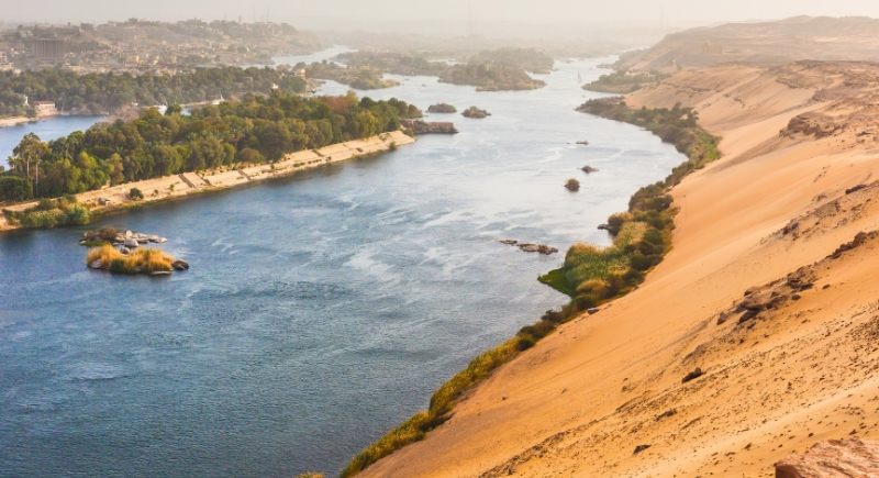
For centuries, the Nile has been considered the longest river. However, recent studies say that the Amazon might be longer if you count certain tributaries. There is a river-measuring controversy, and experts still debate which is truly the longest. Either way, both rivers stretch across continents and shape life along the way.
Does the Equator Pass Through the U.S.?
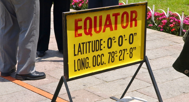
Not even close. The equator crosses through countries like Ecuador, Brazil, and Indonesia, but it never touches the U.S. It stays far below North America. So, no matter how hot it gets in Texas, you’re still not standing on the world’s middle line.
Toronto: Capital of Canada?
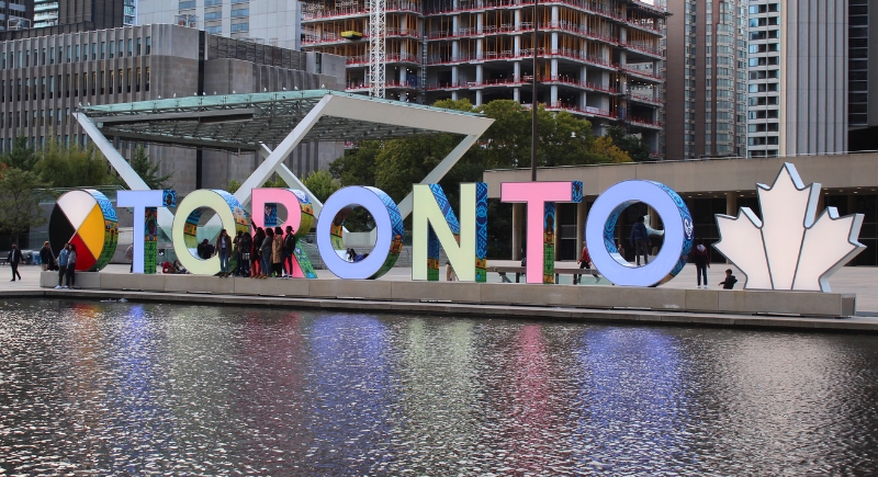
Despite being the largest and flashiest Canadian city, Toronto isn’t the capital. That title belongs to Ottawa, which sits quietly between Ontario and Quebec. The location was chosen as a political compromise, not for star power.
Holland vs. The Netherlands: Same Thing?
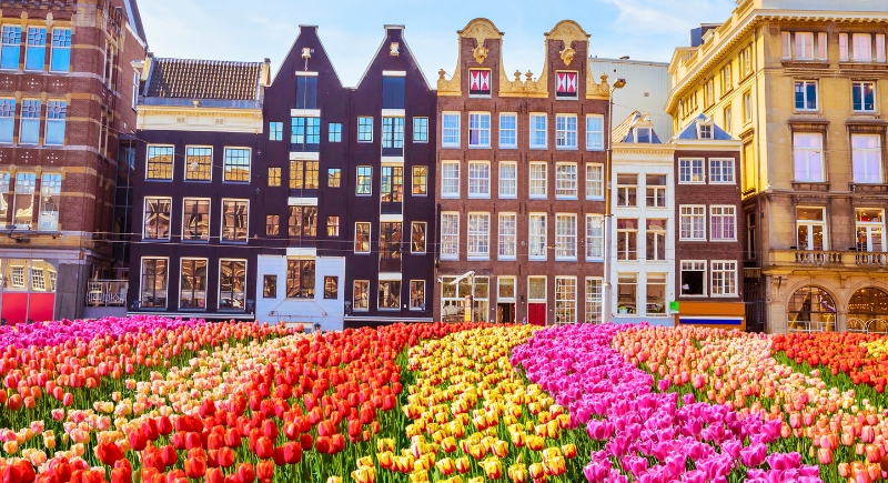
Not quite. Holland refers to just two provinces—North and South Holland—inside the Netherlands, which has 12 provinces in total. Saying “Holland” when you mean the Netherlands is common but technically inaccurate. Think of it like calling all of America “California.”
Statue of Liberty: New York or New Jersey?
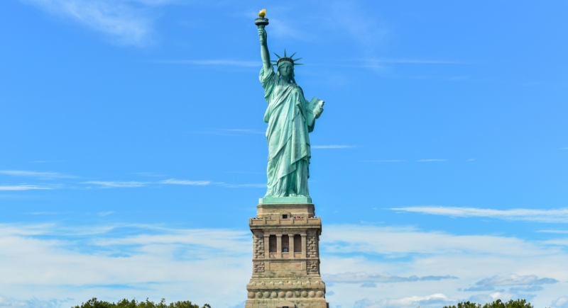
She’s iconic, she’s massive, and technically, she’s in New Jersey’s waters. Liberty Island is closer to Jersey, but due to an old agreement, New York manages it. It’s a rare case of geography and politics sharing a monument. Either way, she’s proudly American.
Is Mount Whitney the Tallest U.S. Peak?
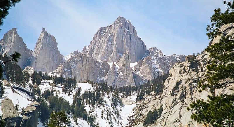
Mount Whitney is the highest mountain in the continental U.S., but Denali in Alaska towers over it. Denali reaches over 20,000 feet above sea level, making it the tallest mountain in North America. While Whitney is impressive, Denali rules the peaks.
Is Russia the Only Country in Two Continents?
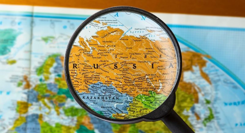
Russia is the largest transcontinental country, straddling Europe and Asia. But it’s not alone. The world’s borders are often blurrier than you’d expect. Turkey, Kazakhstan, Egypt, and Georgia also sit on two continents. Some even debate if Iceland and Cyprus count.
Longest U.S. River: Mississippi or Missouri?
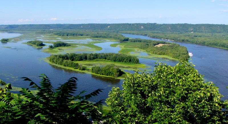
The Mississippi gets all the attention, but the Missouri River is longer. It is the longest river in the United States, considering that it stretches about 100 miles farther. It’s less famous, but it carves through more states and through more geography textbooks.
Great Britain = United Kingdom?
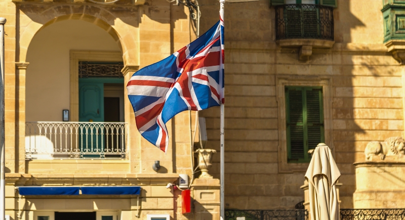
Not exactly. Great Britain includes England, Scotland, and Wales. The United Kingdom adds Northern Ireland. So, while they’re often used interchangeably, they’re not the same. If you want to get it right, think of the U.K. as Great Britain plus a little extra.
Kansas City: In Kansas, Right?

Partially! Kansas City overlaps the border, but most of it—including downtown, stadiums, and BBQ fame—lies in Missouri. It’s one metro area with two states involved. It could be confusing, but we can’t deny that the flavors around this space are absolutely delicious. Just don’t assume you’re in Kansas when you’re eating ribs.
Antarctica: No Time Zones at All?
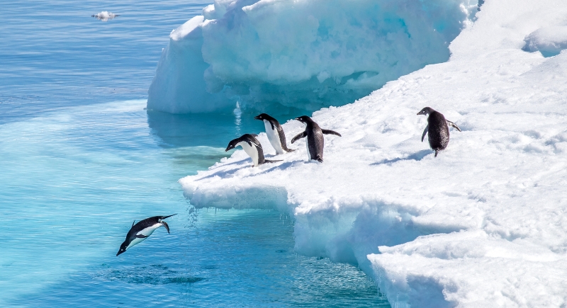
Actually, Antarctica uses multiple time zones. Research stations follow different clocks—some use their home country’s time, others use supply base time. Since there’s no permanent population, there’s no standard time zone. Time down there is flexible and very, very cold.
Africa: Mostly Jungle?
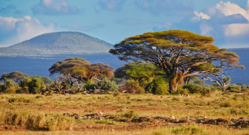
Nope. Africa’s geography is as diverse as its cultures, and it’s way more than just a jungle. While it does have lush rainforests, especially in the Congo Basin, most of Africa consists of deserts, savannas, and open plains. The Sahara alone dominates the northern third.
Can You See the Great Wall from Space?
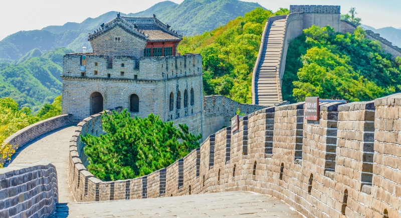
No, not without help. Despite popular belief, astronauts say it’s nearly impossible to spot with the naked eye. The Wall is narrow and blends into the landscape. Cities, highways, and airports are far easier to see. While the Great Wall is still great, it is just not visible from orbit.
Australia: Country and Continent?
Yes—Australia’s the only country that covers an entire continent by itself. It’s surrounded by ocean, has no neighboring countries, and stretches across three time zones. It’s a continent, a country, and a kangaroo-packed wonder all rolled into one.
Mount Everest: Tallest Mountain?
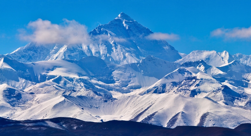
Mount Everest is indeed the tallest mountain but from sea level. From base to peak, Hawaii’s Mauna Kea is taller. Most of it sits underwater, but from its ocean floor base to summit, it beats Everest by over 3,000 feet. Everest wins the fame—but Mauna Kea wins in raw height.
Which U.S. State Is Closest to Africa?

It’s not Florida, even though it feels like the obvious answer. Maine holds the title. Specifically, a point near Quoddy Head is the closest spot in the United States to Africa. The distance to El Beddouza, Morocco, is about 3,154 miles across the Atlantic. This makes Maine the nearest U.S. state to Africa, beating Florida by nearly 1,000 miles.
Is the Sahara the World’s Biggest Desert?

While the Sahara is the largest hot desert, covering about 3.5 million square miles, the world’s largest desert title is Antarctica. Despite its icy landscape, Antarctica qualifies as a desert because it receives less than 2 inches of precipitation annually. Spanning approximately 5.4 million square miles, Antarctica’s cold, arid conditions make it the largest desert on Earth by area.
Which Country Borders the Most Nations?
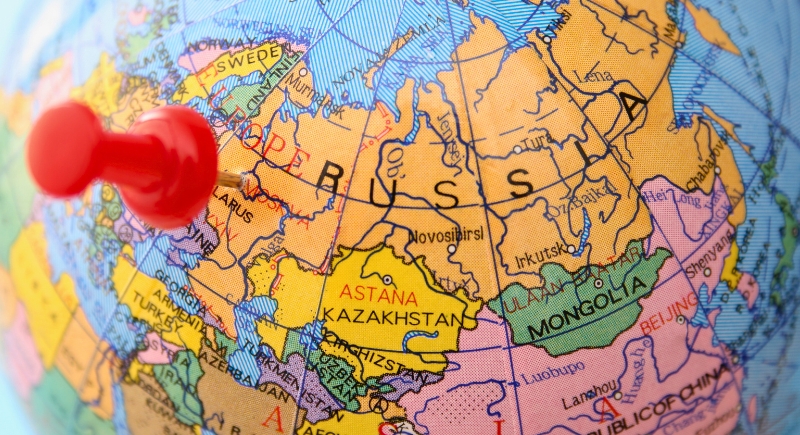
You might think it’s a close call, but Russia wins this one hands down. It borders 14 countries, stretching from Europe to Asia like a land-hogging giant. China comes close with the same number if you count every disputed border, but Russia still claims the crown. It’s the world’s nosiest neighbor with a foot in everyone’s yard.
Which Continent Hosts the Most Countries?
Africa isn’t just home to safaris and pyramids; it’s also the continent with the most countries, clocking in at 54. That’s more than a quarter of all nations on Earth. From island states to landlocked nations, the continent is a patchwork of borders, languages, and flags. If geography were a party, Africa would bring the most guests.